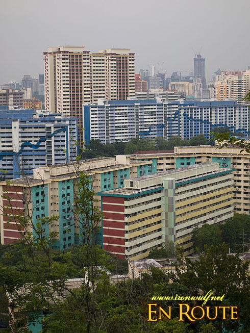
Singapore buildings view from Mt Faber
When I was staying in Singapore, there’s always the search on where to go next. I know Singapore doesn’t have much in terms of nature and hike trails aside from Pulau Ubin, but it didn’t stop me from visiting Mt Faber located near Bukit Merah. It’s the highest spot in Singapore for a measly 105meters above sea level. But I’m keeping an open mind. So I hopped a bus to Vivo City Mall where the trail starts.
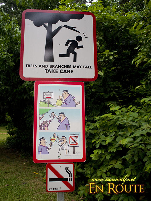
Precautionary signs at Marang Trail
It’s funny thinking about it that a mall is the jump off to a mountain, but hey, this is Singapore and they make it really convenient for a lot of people. Just across the street from the mall is the start of Marang Trail. There are actually several entry points to Mount Faber but I decided to choose this one just to get a little blood rush on this short hike. One other option is to ride a bus up to the summit.
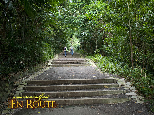
Good forest cover at Marang Trail
At the start of the trail there’s an easy to follow trail guide. I’m pretty sure it’s not easy to get lost here. Night hikers or joggers should bring their own light as the trail is not lit. There are also amusing trail signs along the way like beware of falling branches, a cartoon of refrain from feeding wild animals and a straightforward no smoking sign.
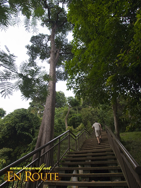
Stairway up the Marang Trail
As expected, the trail is paved with stairways elevating up to 70meters or about 24 storey of a building. It’s a good cardio workout for anyone who wants to get into stair climbing. There were actually a few people who were jogging and stair climbing at that time.
At faber walk Park
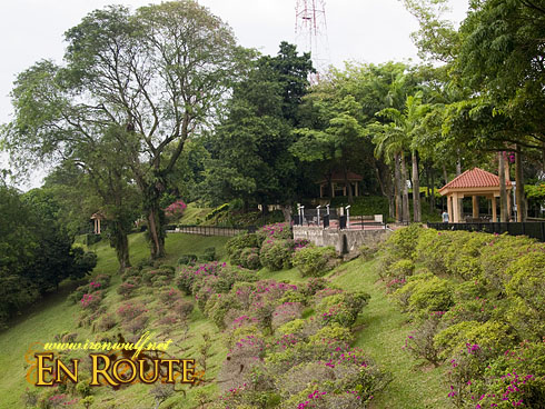
At the end of the trail is the well paved road of Faber Walk. I stayed on some benches there for a while as the Marang Trail does let up a sweat for a 30 to 45 minute climb. There’s a nice panorama of the southern part of development in Singapore. Continuing the walk, the north side has a sea of buildings as view. Yes this is Singapore alright, populated by high rises and other structures.
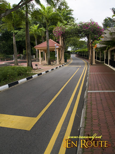
Neatly paved Faber Walk Road
I finally reached the center of Faber Walk which has the site marker as the highest point in Singapore. There is also one small Merlion there. There are actually only 5 recognized Merlion statues by Singapore Tourism Board and the one here at Mt Faber Point is one (the others being the two at Merlion Park, the one in Sentosa and the other at Tourism Court, Grange Road).
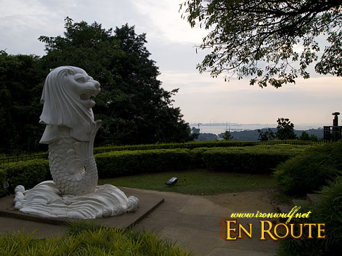
The small Merlion at Mt Faber Summit
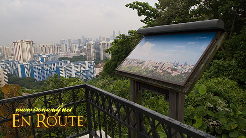
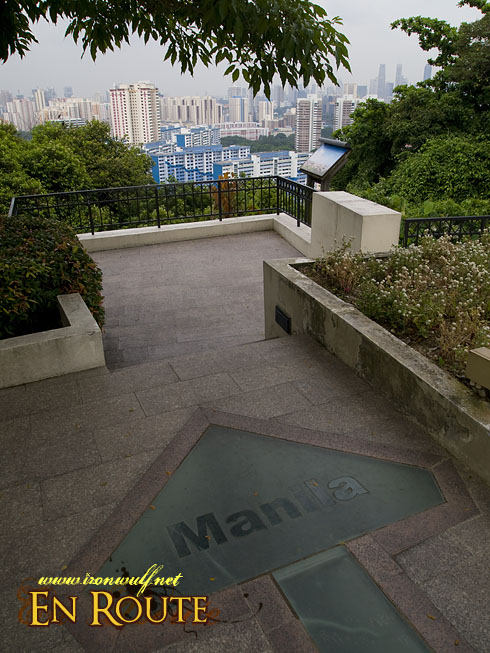
Aside from the Merlion there are view points and arrow markers leading to neighboring Cities from other countries. Of course there are more views of buildings that there are marker guides for which building is which.
Mt Faber Singapore Viewpoint
I continued my walk westward down the slopes of Mt Faber. I didn’t realize I took the longer south route of the loop when I took some stairs descending from the Faber Point markers. But I don’t mind, it was a pleasant walk, dodging some joggers only a few times on the pedestrian trail. I’m now headed to the Southern Ridge.
This way to Manila

Ferdz Decena is an award-winning travel photographer, writer and blogger. His works has found print in publications such as Singapore Airlines’s Silver Kris, Philippine Airlines’ Mabuhay, Cebu Pacific’s Smile and Seair InFlight. He has also lent his expertise to various organizations like the Oceana Philippines, Lopez Group Foundation, Save the Children and World Vision, contributing quality images for their marketing materials.